- Policy Analysis
- PolicyWatch 3719
Mapping the Islamic State's Activity: Implications for U.S. Counterterrorism Policy

Three experts unveil a powerful new interactive tool designed to help policymakers, scholars, journalists, and the general public better understand and analyze the Islamic State’s global reach.
On March 21, The Washington Institute held a virtual Policy Forum with Aaron Zelin, Gina Ligon, and Thomas Hegghammer to debut the Islamic State Select Worldwide Activity Map, a vast public archive that provides an accessible way to search, track, and understand the organization’s global reach. Zelin is the Richard Borow Fellow in the Institute’s Reinhard Program on Counterterrorism and Intelligence; he spearheaded the interactive map project, which is dedicated in loving memory of Mr. Borow. Ligon directs the National Counterterrorism Innovation, Technology, and Education Center at the University of Nebraska Omaha. Hegghammer is a senior fellow in politics at All Souls College, Oxford University. The following is a rapporteur’s summary of their remarks.

Aaron Y. Zelin
Washington Institute staff have been working on the Islamic State (IS) activity map since August 2021, with the goal of providing a novel way to understand the group’s activities and illustrate them more clearly than text alone could. The tool also moves beyond a traditional scholarly focus on attack data, offering content from IS media, designations, and legal cases. (Watch a video explaining the map’s features in English or Arabic.)
While IS may have receded from headline news coverage, a jihadist resurgence could occur anytime, especially given the growth of IS “provinces” in sub-Saharan Africa and South Asia. The generational incubation occurring in Syrian camps such as al-Hawl is worrisome as well.
Prior to the organization’s rebranding and reemergence in 2013, many officials and researchers believed that IS and its predecessors had been defeated. This history is now repeating itself in the group’s “post-territorial control” phase. Although focusing on today’s wide constellation of other pressing geopolitical concerns is no doubt warranted, the present lull between large-scale jihadist mobilizations should not be mistaken for an end to the challenge. And whether or not IS recaptures territory and resumes large-scale external operations, the Institute’s new interactive map will give researchers and officials a one-stop repository for understanding what is happening.
Although the map includes large amounts of information, it carefully separates the signal from the noise, offering a corrective to the glut of unorganized IS data floating in the public domain. Users will find clear, well-categorized capsules that tell the organization’s much larger story. The map is not intended to track every last IS operation, but rather to collect key information points since the group’s founding in Herat, Afghanistan, in 1999. Of course, the group became far more active after its early years, dramatically increasing both its attacks and its efforts to describe its project. Indeed, the map highlights the group’s transnational nature by analyzing its multilingual propaganda, as well as legal cases related to activities around the globe.
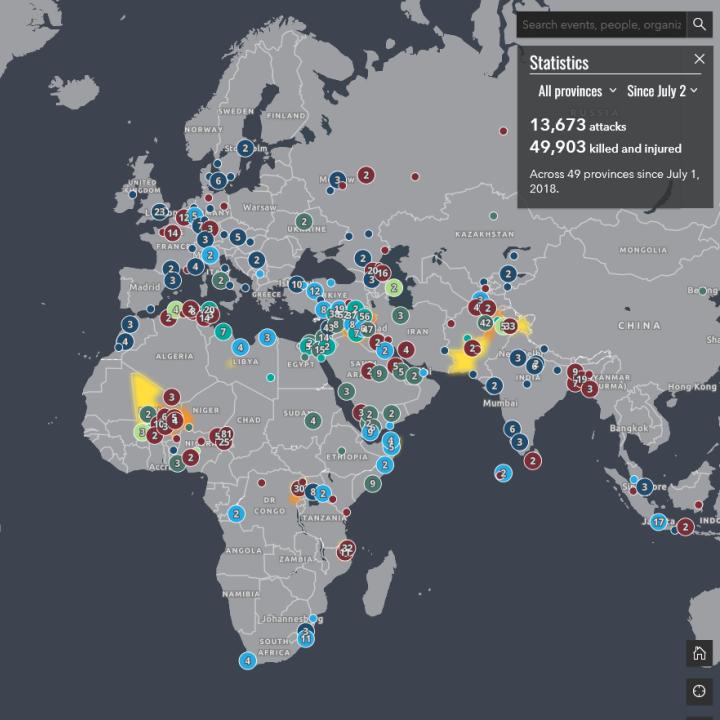
This map is unique in being produced almost entirely from primary source materials. It draws from IS official media releases, government press releases, and court documents, and is searchable by category, location, keyword, and the group’s various phases and names. It also contains statistics on global attacks based on claims of responsibility in the group’s weekly al-Naba newsletter, dating back to July 2018, when IS began to share such data more regularly and methodically.
Notably, the map does not include violent visual content involving people, even as it catalogs depictions of violent acts such as the burning of buildings and boasts about casualties. The point is not to censor the reality of IS extremism and brutality, but rather to prioritize the mental welfare of users.
The launch is just the beginning of what will be a “living” project, with continual updates covering new developments and modifications to older entries. Potential future additions include a filtered timeline feature, which will allow users to better disaggregate data. Other entries may include information related to the State Department’s Rewards for Justice Program, press releases from the Pentagon and U.S. Central Command regarding the killing of IS leaders, and information on the repatriation of former IS members.
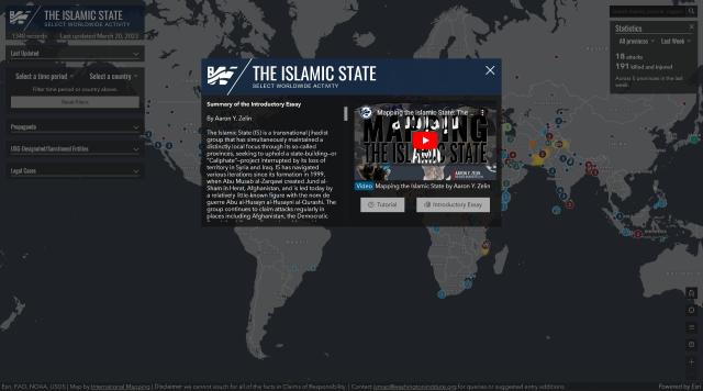
The map’s introductory essay and tutorial provide further technical details on how to access and collate these points. Users are encouraged to submit specific or general feedback and documents using the mail widget.
Gina Ligon
This project builds on Aaron’s work at Jihadology.net and provides a fascinating arrangement of IS content in a digestible format. With the shift in U.S. government resources away from counterterrorism and toward great power competition, U.S. analysts have fewer applications and training related to this subject today than during the War on Terror. Therefore, this map will be extremely useful for analysts, particularly those who are tracking transnational actions. The repository of primary sources provides rich information on the group’s operations, organizational development, and tactical evolution that will be very useful for criminal investigators as well.
In addition, the map is extremely effective as an educational tool and will surely be used in coursework, onboarding, and training for the U.S. government and within universities. Based on my work in providing grants for counterterrorism research, I know that it will also facilitate cutting-edge research on the group’s development, leadership, and media apparatus, and on U.S. government action against IS. Overall, the map looks toward the future of higher education for students and young analysts who prefer to use interactive exploration tools to gain knowledge on key issues like IS.
Thomas Hegghammer
This map makes several contributions to the body of research on IS. It provides a useful and reliable tool for gaining an overview of the organization’s past and present. It also shows how broadly transnational the group is, allowing users to identify high activity zones in the Middle East, Africa, Afghanistan, and Pakistan. By using its multilayered filters, researchers can obtain highly granular information on IS activities.
The map also provides a novel data visualization tool that mixes incident and document data, which differentiates it from previous tools created by the National Consortium for the Study of Terrorism and Responses to Terrorism (START) and the Armed Conflict Location and Event Data Project (ACLED). Through this data mixing, the map provides a better-grounded overview of IS activity, while the visual format provides a more interesting way to digest this material.
Overall, the project highlights the importance of compiling good, accurate data for research. It also sends an important message to politicians and donors regarding the importance of supporting data compilation on important issues even when they are not at the top of the news every day.
This summary was prepared by Sarah Cahn. The Policy Forum series is made possible through the generosity of the Florence and Robert Kaufman Family.


