David Makovsky is the Ziegler Distinguished Fellow at The Washington Institute and director of the Koret Project on Arab-Israel Relations.
Explore the geography and demography of Israeli settlements in this first-of-its-kind interactive mapping tool.
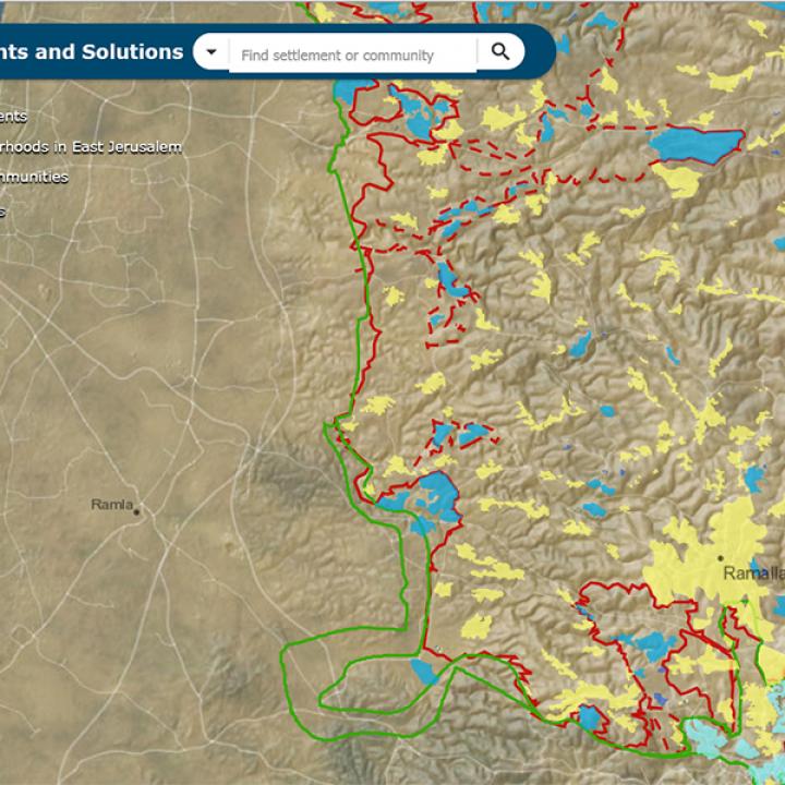
Is a two-state solution still possible for Israelis and Palestinians? Part of answering this question requires understanding the geographic distribution of Israeli settlements in the West Bank. The Washington Institute's interactive project, Settlements and Solutions, is a first-of-its-kind web-based geographic database that provides users engaged with the issue of the Israeli-Palestinian conflict a reliable source to explore Israeli settlements in the West Bank. This tool details the geographic delineation of settlement activity, thereby allowing its users to understand the importance and context by which the settlement activity occurs.
Users of this mapping tool can explore settlement geography and demography and decide for themselves whether, given the circumstances on the ground, a two-state solution is still possible. Originally created in November 2017, the tool has since been updated to show the territorial and demographic ramifications of the Trump administration's January 2020 peace plan.